Jakhau Fm
Type Locality and Naming
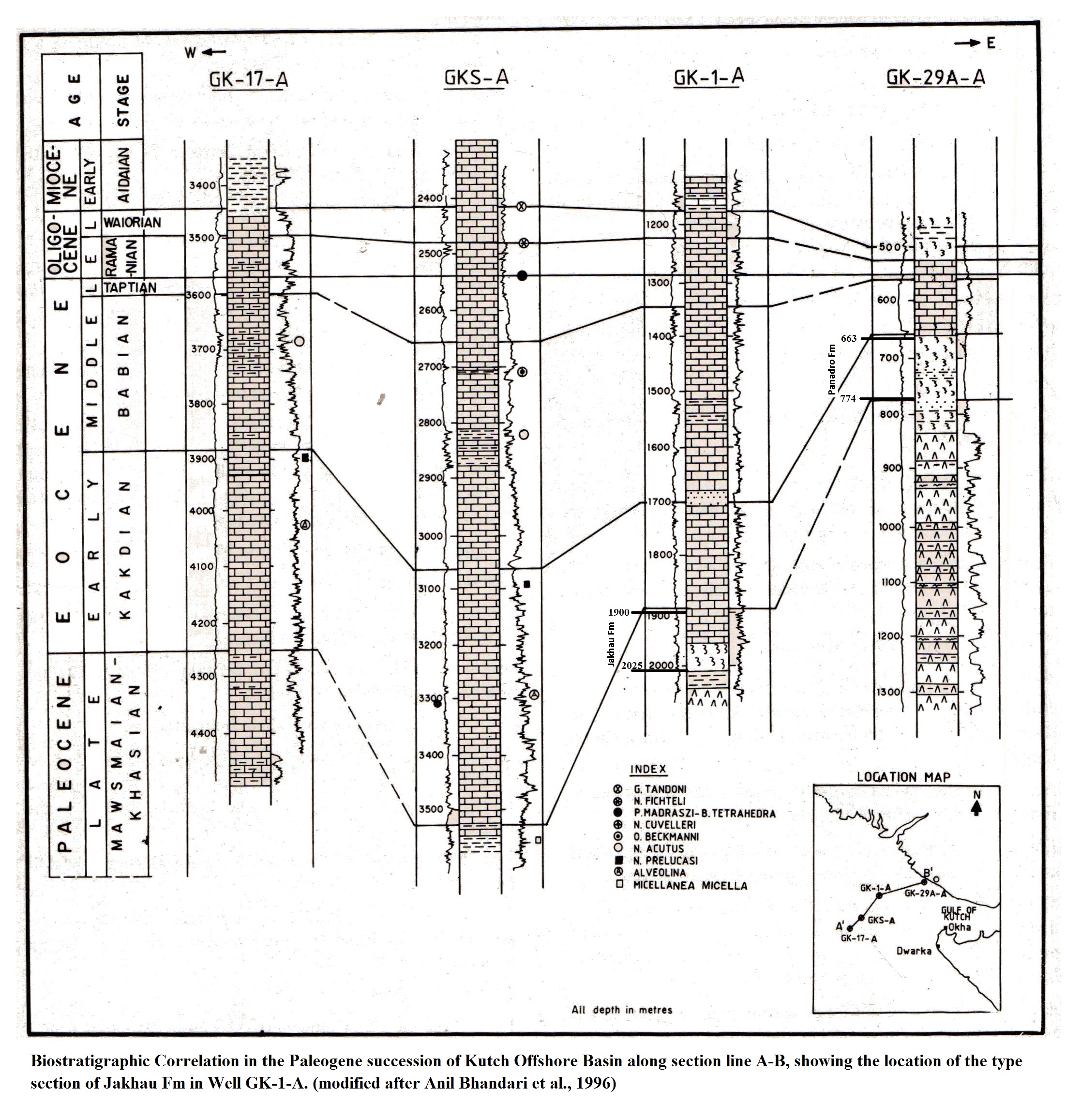
SUBSURFACE. Interval 1900-2025m in well GK-1-1. [Original Publication: Zutshi, P.L., Mittal, S.K and Shah, L. (1993) Lithostratigraphy of Indian Petroliferous Basins, Document IV, Kutch Saurashtra Basin, KDMIPE, ONGC Publication, pp 1-50.]
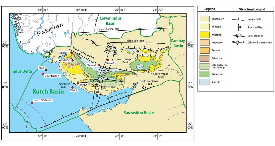
[Fig. Geological and structural map of Kutch, also showing the onshore and offshore wells drilled for oil exploration. (Map by Rasoul Sorkhabi in GeoExpro Dec2014, based on various sources including S.K. Biswas, Current Science, 25May2005)]
Lithology and Thickness
Clayey limestone. Consists of dominantly clayey foraminifera packed limestone which is partially dolomitized and occasionally pyretic. The formation has Coal bands at the top. Maximum thickness in well KD-1 is 255m; the thickness increases to 485m in GKS-1.
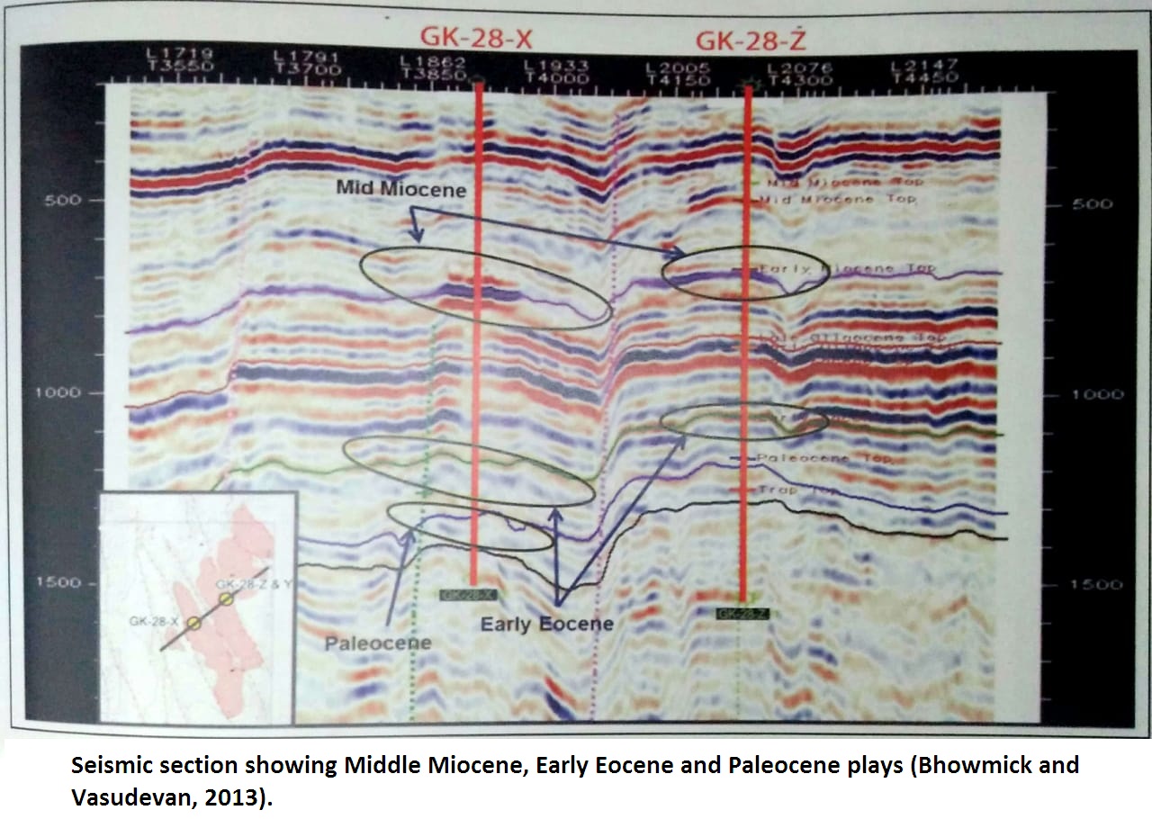
[Figure 1: Seismic section showing Middle Miocene, Early Eocene and Paleocene plays (after Bhowmic and Vasudevan, 2013)]
Relationships and Distribution
Lower contact
Unconformably underlain by Nakhtarana Fm or Panadro Fm
Upper contact
Unconformably overlain by Fulra Limestone Fm in Kutch offshore, and marked by sharp fall in resistivity and gamma logs.
Regional extent
GeoJSON
Fossils
N. globulis, A.spinosa, and G. subbotinae
[Figure 2: Biostratigraphic Correlation in the Paleogene succession of Kutch Offshore Basin along section line A-B, showing the location of the type section of Jakhau Fm in Well GK-1-A. (modified after Anil Bhandari et al., 1996)]
Age
Depositional setting
Shallow warm water, inner shelf environment is suggested in the eastern part of the Kutch offshore.
Additional Information


